THANK YOU FOR SUBSCRIBING
Aerospace and Defense Review Weekly Brief
Be first to read the latest tech news, Industry Leader's Insights, and CIO interviews of medium and large enterprises exclusively from Aerospace and Defense Review


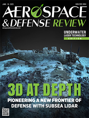
Monitoring subsea assets and their infrastructure in cold and dark waters requires unique technology to truly determine its health and status at any given time. This technology needs to help asset owners and specialized marine engineers make informed decisions based on real time data.
While sonar and purpose-built cameras offer some level of 2D and 3D spatial awareness they do not come close to providing the level of intricate detail and data collection efficiency of a repeatable 3D Subsea LiDAR (SL) data point cloud.
A pioneer in commercial-scale SL and underwater laser technologies, 3D at Depth specializes in end-to-end customer service, designing and delivering advanced data using its SL solutions and subsea survey support services.

From data collection and processing to visualization and analysis, 3D at Depth provides a diverse range of solutions that offer precise, accurate, repeatable, and millimetric 3D point clouds to better monitor and maintain underwater assets. One of their flagship products includes the new SL 4 with scanning speed up to 6 times faster than its predecessors.
“Since its inception, our design philosophy has been to maximize the number of capabilities and applications within a single solution. This is largely due to the expense and time required to reach up to 4,000m depth subsea. For this reason, the SL technology offers customers the ability to collect 3D point clouds, time, intensity, measure movement, volume, vibration, and detect leaks, which are all crucial to identify asset economic life and prevent damage to seafloor or subsea located infrastructure. In security markets this is also useful for target detection, classification, and identification. We call this our Solution Suite,” says Carl Embry, 3D at Depth’s CEO.
A Steady Reputation
3D at Depth has a track record of successfully completing numerous notable projects worldwide, helping old and new clients unlock the true value of underwater 3D data with its suite of SL solutions. In a recent underwater pipeline maintenance project, they assisted a leading oil and gas operator in efficiently determining damage while keeping their operational costs low. The use of its standard SL system enabled the surveying unit to gain a clear understanding of overall damage, including bent pipes buckling and damaged thermal coatings. Accurate data regarding the radius, ovality of curvature and the stress levels inherent in the system were captured, allowing the customer to allocate appropriate resources for immediate and longer-term remediation, without disrupting the transmission of hydrocarbons needed for domestic energy consumption- saving the client millions of dollars.
This is just one instance where 3D at Depth’s Solution Suite helped clients make informed decisions in extreme environments, allowing them to streamline asset management operations. To date 3D at Depth has successfully captured accurate data in over 800 global offshore projects. A testament to this solution is the short notice needed for project mobilizations, mainly located in deep water remote ocean locations globally, often proving a challenge in harsh environments.
Drawing on these successes and years of industry experience, the company is now gearing up to offer its proven SL solutions to customer owned vehicle solutions (from crewed to fully autonomous). 3D at Depth sees large opportunities and benefits for the defense community, presenting an excellent opportunity to revolutionize subsea activities.
Charting a New Course for Defense
“Our proven, robust sensors and systems can answer the defense community’s need for a standard LiDAR to use during covert operations,” says Embry.
3D at Depth’s portfolio of subsea LiDAR systems includes SL4 and customized solutions. Time-tested on over 800 projects in c. 20 countries worldwide, across 6 continents down to depths of up to 4,000m, the standard solution has demonstrated visual ranges up to 45 meters in the open ocean. It has effectively assessed underwater assets in most environment types, outperforming camera-based solutions, which have range and turbidity restrictions. In addition, SL4 offers a 90x360-degree field of view when utilizing a pan and tilt mounting, making it ideal for omni-directional seabed inspections from a single location. For instance, defense units patrolling the Nord Stream pipeline within the exclusive economic zone and beyond can map, monitor, and evaluate areas around the asset under protection, enhancing surveillance and supplementing their security initiatives. The superior resolution, accuracy, and range of LiDAR over other acoustic and camera-based systems make the system ideal for detection, classification, and identification of foreign objects.
The true value of SL4 solutions lies in its ability to collect accurate data for informing critical security decisions. The enhanced precision capability goes down to sub-millimeter-level accuracy, capturing even minute cracks or delamination of metal. Base images are made up of 2.1 million measurements per sector to provide highly accurate 3D LiDAR point cloud data.

SL4 has improved data collection six times over the previous generations. Even in deep waters, the collection time and data quality far exceed conventional inspection expectations, earning its place as the preferred choice for various remote operations. Advanced data processing features further complement all these capabilities.
"Our vision is to help military agencies better leverage this proven, robust technology for their needs without requiring substantial time and resources for technology development"
SL4 has improved data collection six times over the previous generations. Even in deep waters, the collection time and data quality far exceed conventional inspection expectations, earning its place as the preferred choice for various remote operations. Advanced data processing features further complement all these capabilities.
Turning Data Acquisition into Answers
“Data processing is, after all, where the data collected becomes informative and provides answers. By providing an intuitive experience, we are enabling users to transform the way they survey and monitor their assets. Our turnkey solutions don’t just measure objects; they analyze and identify them, giving them multiple layers of informative critical data from a single scan,” says Neil Manning, 3D at Depth’s COO.

3D at Depth’s sensors are built to integrate with different platforms, ROVs, and AUVs and come with an application programming interface API that facilitates system control even within a client custom/bespoke interface. This includes the ability to manage and control vehicle behaviors from collected data in near real time. Terrestrial laser scanners primarily adhere to generic data formats and standards, meaning the results can be fed into processing platforms, including GIS and CAD software solutions allowing measurement and analysis. The SL products follow this workflow and offers data results in industry standard formats. As a result, the image clarity far exceeds that of existing subsea optical systems and camera-based solutions. The result is a full software suite package offered by 3D at Depth, including real-time data processing, for collection (3D Collect), viewing (QuickView), and the creation of LAS and E57 files (3D Cloud file formats).
A Fully Integrated Solution
The advanced data analytics capability and SL systems have been added to Cuvier Deep making it ideal for subsea inspection. This fully integrated solution combines a hovering supervised autonomous or tethered electric UUV package with 360° maneuverability, six degrees of freedom, and inertial
| Share this Article: |

Company
3D at Depth
Management
Carl Embry, CEO, Neil Manning, COO
Description
3D at Depth is the world's leading commercial deep-water LiDAR technology company. It has now poised itself to bring its LiDAR solutions to the military and defense niche. The insights-driven have been used to inform decisions regarding the evaluation and management of offshore assets, submerged environments, and water-filled infrastructure, even at the most challenging depths and environments. The technology is now moving into security applications to improve the covert detection, classification, and identification of underwater foreign objects.
3D at Depth News
Harvest, 3D at Depth Team in North Sea Project

The entire operation was conducted with less than 1Mbs of bandwidth and usedboth 4G (broadband cellular network) and VSAT (two-way satellite) connectivity.
“We chose Harvest because the technology provides high-fidelity, two-way audio communications, frame-synchronized video, and optimal bandwidth efficiency. This was essential in providing our remote personnel onshore with the situational awareness and communications channels to perform remote laser scanning safely and efficiently,” said Tarry Waterson, Operations & Client Lead, 3D at Depth.
The work scope involved 3D at Depth’s LiDAR laser scanning technology being deployed by ROV and controlled from onshore using 3D at Depth’s own remote operations technologies. This allowed 3D at Depth personnel to run the project from their Aberdeen office, reducing the requirement to mobilise personnel to the vessel.
Harvest’s proprietary Nodestream technology was mobilized onboard the offshore subsea construction vessel to support 3D at Depth with its subsea metrology operations, enabling real-time situational awareness, and included ROV video feeds, sonar and navigation screens.