THANK YOU FOR SUBSCRIBING
Aerospace and Defense Review Weekly Brief
Be first to read the latest tech news, Industry Leader's Insights, and CIO interviews of medium and large enterprises exclusively from Aerospace and Defense Review


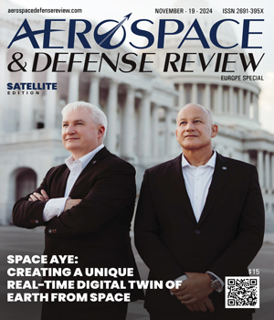
 Chris Newlands, CEO & Founder, Steven Mail, Director
Space Aye, a Scottish space tech company, is at the forefront of this convergence which will revolutionize decision-making across all industries.
From Bali’s Beaches to Pioneering Satellite Innovation
Space Aye began its journey with a groundbreaking concept: Spelfie (space selfies) was designed to capture live events from space. While satellite technology was not new, Space Aye introduced a revolutionary feature of identifying individuals within real-time satellite images. This capability gained significant attention during a BBC documentary aired in November 2019. The project centered on a beach in Bali, where two young activists, Isabel and Melati Wijsen, had successfully campaigned to ban plastic bags through their organization, Bye Bye Plastic Bags. They orchestrated over 300 local villagers to form the words “Act Now”, using 300 meters of white cotton fabric to amplify their message. Remarkably, despite 98 per cent cloud cover on that day, an AIRBUS Defence and Space satellite captured this powerful image from space, pinpointing the exact locations of the participants, who also documented the event with smartphone selfies.
 Following this surge in popularity, Space Aye continued to refine its technology and secured its US patent in 2021, establishing a strong IP foundation. Unlike traditional solutions that use static maps and historical satellite imagery, it innovatively combines IoT data with real-time satellite imagery. Existing solutions place IoT location data “on” the map or historic satellite image, whereas Space Aye identifies the person, asset or livestock “in” the real-time satellite image – a significant advancement over conventional methods.
Spelfie and Space2Site, are available in app stores and these solutions have allowed the company to test, refine and prove its systems, addressing real-world challenges and user needs.
Building on these successes, the company is now developing an industrialized platform adopting the lessons learned from their prototype applications.
-
Our goal is to commercialize real-time satellite imagery, creating mass-market adoption and a new commercial model for the entire EO Sector
“These solutions served as market tests, demonstrating the viability of Space Aye’s technology as a proof of concept. Today, Space Aye has its sights on an ambitious goal—to simplify and standardize the processing of all EO satellite imagery. This initiative represents a significant step toward transforming how data is accessed, marking a new era in real-time geo-locational applications,” states Chris Newlands, CEO & Founder.
“AI Classifies and Space Aye Identifies”
In a nutshell, the company now develops products and services that equip decision-makers with real-time insights and accessible data. Space Aye’s unique approach can be summarized as “AI classifies and Space Aye identifies” enabling its customers to categorize visual data whilst interpreting and personalizing it, making data interactions more useful and effective for users.
Their patented methodology captures a myriad of IoT data which includes location information, biometrics from wearables, audio, video, and static images and seamlessly integrates it with diverse satellite image formats utilizing metadata. This fusion creates an unparalleled, contextualized view of the world.
At the heart of Space Aye’s innovation is the ability to use a broad spectrum of real-time satellite imagery. This includes optical sensors, synthetic aperture radar (SAR), hyperspectral imaging, infrared technology, and lidar. Beyond satellites, they can incorporate high-altitude pseudo satellites (HAPS), CCTV systems equipped with facial recognition, drone footage, and imagery from helicopters and fixed-wing aircraft. By amalgamating these sources, Space Aye places data, people and assets in context from a vantage point that only space can provide.
“Our patents protect the methodology of merging real-time satellite imagery with IoT data,” adds Newlands.
 These patents have already been granted in the United States, China, Japan and South Korea, with granting in other key territories anticipated soon. This strong intellectual property position underscores Space Aye’s commitment to innovation and provides a solid foundation for its technological advancements. For instance, while traditional AI systems can classify elephants, Space Aye’s platform could identify them and assess their health and other biometrics by combining integrated multi-source technology (IMT) data with real-time satellite imagery. This provides vital data that current technologies may not capture as accurately, offering more profound insights into wildlife health and their conservation.
These disruptive innovations support crucial decisions in sectors such as defense, agriculture, forestry and disaster response. For example, farmers can monitor crop health in agriculture in real-time, allowing for timely interventions that enhance yield and sustainability. In disaster response, emergency services can access immediate situational awareness including biometrics and location of survivors, enabling them to deploy resources more effectively and save lives. By facilitating informed strategic planning and enhancing the ability to act swiftly and effectively, Space Aye’s technology is transforming how organizations respond to complex challenges.
Simplifying Satellite Imagery
“Our goal is to commercialize real-time satellite imagery, creating mass-market adoption and a new commercial model for the entire EO Sector.” says Steven Mail, director. “We’re making access to a complex data set simple and user friendly, that every industry can leverage.”
Accessing real-time satellite imagery has long been complex, requiring specialized knowledge and navigating a maze of incompatible image formats. Recognizing this challenge, Space Aye is harmonizing these processes by making satellite imagery as accessible as a simple JPEG file.
Space Aye is a customer and a supplier of real-time satellite imagery merged with IoT data. This dual perspective gives the company deep insights into the obstacles users face, particularly the issue of interoperability as there are over 20 different satellite image formats. Seeing this fragmentation as a barrier to widespread adoption, it developed a solution that retains vital metadata while converting images into 1 universally accessible format. Space Aye is also prepared to adopt new formats to stay ahead of technological advancements, ensuring readiness for future changes.
“It wasn’t simple when we started the journey in 2017,” says Newlands. “We had to create the ability to share data in a format everyone could use on smart devices. Therefore, we have solved many of the challenges users experience today.”
Space Aye plans to ensure its powerful technology is used responsibly, balancing robust capabilities with stringent privacy standards. While AI systems can process vast amounts of data, they must do so without compromising individual identities therefore upholding fundamental human rights and privacy laws.
Its efforts are not just about technological advancement but about creating a new commercial model for the entire Earth Observation (EO) sector. Space Aye aims to foster mass-market adoption by democratizing access to satellite imagery.
Enhancing Security and Accountability Through Partnerships
Space Aye can leverage IoT to enhance security and monitoring capabilities within geofenced areas from space, important to protect critical national infrastructure. By integrating advanced technology, this platform effectively manages unauthorized access, enabling remote personnel to swiftly respond to threats and secure sensitive locations.
Space Aye’s platform could also extend to broader security challenges with significant economic and environmental impacts. For example, it could combat oil and gas theft, a crime leading to substantial financial losses and severe risks to the environment and public safety. The platform will identify authorized personnel and vehicles in satellite images, AI could then be utilized to identify unauthorized activity. This advanced surveillance mechanism is crucial to safeguarding resources, protecting ecosystems and enhancing national security, potentially saving lives and curtailing losses.
Space Aye benefits immensely from its strategic location. Glasgow ranks as the third-largest manufacturer of satellites globally, a testament to its rich scientific heritage and forward-looking academic institutions. This environment equips Space Aye with a vast talent pool, from astute legal advisors to cutting-edge developers and scientists.
It prides itself on being the “intelligent client” in collaborations with some of the world’s largest organizations. Despite significant challenges, including stringent regulatory hurdles and the technological demands of space innovation, Space Aye has not only endured, but emerged stronger.

The ability to monitor and respond to real-time events on Earth—from wildfires to the movements of endangered species— underscores the potential for a future where global monitoring and intervention occur seamlessly.
Among the key initiatives which could benefit from Space Aye’s solutions is the Allied Persistent Surveillance of Space (APSS). The ability to integrate and process vast amounts of data is crucial here. The military principle of OODA (Observe, Orient, Decide, and Act) finds significant application in this context. By applying this strategic framework to modern technology, mainly through IoT devices, a transformative approach to gathering and contextualizing information enhances decision-making processes, offering the higher ground.
A Real-Time Digital Twin of Earth
Looking ahead, Space Aye envisions contributing to the creation of a digital twin of Earth - a dynamic, virtual replica of our world continuously updated through data streams from satellites and IoT devices. This ambitious project promises unprecedented interaction with the environment, enabling more responsive and precise decision-making on a global scale.
Such a digital twin could revolutionize urban planning, environmental monitoring, and resource management. By providing real-time data and predictive analytics, governments and organizations can make more informed decisions that promote sustainability and efficiency.
As the number of satellites and IoT devices continues to grow, the ability to harness this data effectively will become increasingly important. Space Aye’s innovative approach offers a glimpse into a future where real-time global monitoring and intervention are not only possible but seamlessly integrated into daily operations.
| Share this Article: |

Company
Space Aye
Management
Chris Newlands, CEO & Founder, Steven Mail, Director and Air Marshall Andrew Turner, Director
Description
Space Aye is a Scottish space tech company based in Glasgow. They focus on integrating real-time satellite imagery with IoT data to offer enhanced insights and decision-making capabilities.